
Lakes and Mountains
East of the valley, the Siskiyous climb past the Oregon Caves to lakes above 5,000 feet. West of it lies the Kalmiopsis Wilderness, where the rock is serpentine and the plants are rare. Most of these places sit at the end of long Forest Service roads, so carry water, a paper map, and a full tank.
The Forest Service's Wild Rivers Ranger District, (541) 592-4000, can tell you about roads, fire rules, and snow. For Lake Selmac, north of town, see Selma.
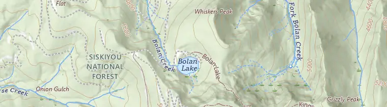
Bolan Lake
Bolan Lake is a 12-acre lake at about 5,300 feet, in the mountains southeast of the valley. The 2020 Slater Fire burned much of the land nearby, but the ring of tall conifers around the lake mostly survived. The campground has 14 first-come sites with tables and fire pits, vault toilets, and no drinking water. You pay on site with Scan & Pay in the Recreation.gov app, so download it while you still have signal.
Bolan Lake Trail #1245 starts in the campground and climbs to the Bolan Mountain lookout. The fire destroyed the lookout, and the Siskiyou Mountain Club rebuilt it with the Forest Service in 2024. It sleeps up to 4 and rents on Recreation.gov in the snow-free season.
Getting there: From Cave Junction, go south on US 199 about 1 mile and turn left on Rockydale Road. After about 7 miles, turn left on Waldo/Happy Camp Road and go about 13 miles to Forest Road 4812. Follow it 4.1 miles to Road 4812-040. The campground is about 4 miles farther.
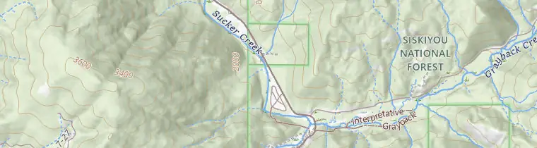
Grayback Campground
Grayback Campground is 12 miles east of Cave Junction on Highway 46, the road to Oregon Caves. It has 39 first-come tent sites, many along Sucker Creek, which is good for wading. There's drinking water, vault toilets, and a day-use area you can reserve by phone. RVs can stay, but there are no hookups. Past Grayback the highway narrows, and the park discourages large RVs and trailers.
The 1-mile Grayback Interpretive Trail is an easy family walk. It goes to Grayback Creek and loops past an old Civilian Conservation Corps camp at Cedar Guard Station.
Babyfoot Lake and Bigelow Lakes
These are two separate trips. Babyfoot Lake is to the west, on the eastern edge of the Kalmiopsis Wilderness. From US 199, turn west on Eight Dollar Road, which becomes Forest Road 4201. It crosses the Illinois River and climbs about 12 miles. Then take Road 140 about half a mile to the trailhead. The lake is about 1.2 miles in, downhill on the way there. The 2002 Biscuit Fire burned the whole area, so expect dead snags and little shade. The trail is open spring through fall, it has no water, and wilderness rules apply.
Bigelow Lakes are to the east, in meadows high on Mount Elijah above Oregon Caves. The long way starts at the cave visitor center: a 9.2-mile loop with 2,390 feet of climbing, which the NPS recommends for experienced hikers. For the short way, take Highway 46 to Forest Road 4613, then Road 070 to the Mt. Elijah/Bigelow Lakes Trailhead at its end. That trailhead has no water or toilets.
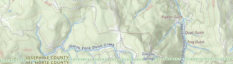
Page Mountain Sno-Park
Page Mountain Sno-Park is a winter parking area for getting out in the snow. From Cave Junction, take Happy Camp/Grayback Road about 10.6 miles to Forest Road 48 (Indian Creek Road). It's open sunrise to sunset for day use only.
From November 1 to April 30, you need an Oregon Sno-Park permit on your windshield. It costs $4 a day, $9 for 3 days, or $25 for the season. DMV offices and permit agents sell them, and annual permits are also sold online through DMV2U. The fine without one is $30.
Check before you go. The latest Forest Service notice we found, from winter 2023–24, said Road 48 had failed in places and wouldn't be plowed. We found nothing newer, so call the ranger district and check TripCheck.
Kalmiopsis Wilderness
The Kalmiopsis Wilderness covers nearly 180,000 acres west of the valley. It was designated in 1964 and enlarged in 1978. It's named for Kalmiopsis leachiana, a small shrub in the heath family that botanist Lilla Leach found here in 1930. Much of the ground is serpentine and peridotite, rock that is toxic to most plants. Wild stretches of the Illinois, Chetco, and North Fork Smith rivers run through it.
The 2002 Biscuit Fire burned nearly 500,000 acres, including the entire wilderness, and damaged about 160 miles of trail. Expect steep, narrow paths with downed trees, missing signs, and loose rock. From the valley, Babyfoot Lake is the easiest way in. No motor vehicles or bikes are allowed.
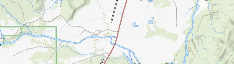
Rough and Ready Botanical Wayside
Rough and Ready Botanical Wayside shows you serpentine plants without a long drive. It's about 4.5 miles south of Cave Junction on the west side of US 199, on the way to O'Brien. A flat 0.3-mile trail runs from a picnic shelter, past signs about the plants and rocks, to an overlook of Rough and Ready Creek. There's an accessible picnic table and a portable toilet, but no water. Entry is free, from sunrise to sunset.
The Illinois Valley Garden Club began working to protect this flat in 1937. In 1994, the Bureau of Land Management set aside 1,164 acres around the creek as an Area of Critical Environmental Concern. Many rare plants here grow only on the serpentine soils of the Siskiyous, so stay on the trail.
On the map: The Siskiyou high country
- Bolan Lake Campground: A 12-acre lake at about 5,300 feet with 14 first-come campsites and no drinking water.
- Page Mountain Sno-Park: A winter parking area on Forest Road 48 for getting out in the snow.
- Kalmiopsis Wilderness: Nearly 180,000 acres of serpentine ridges and wild rivers west of the valley, named for a shrub found here in 1930.
- Babyfoot Lake and Bigelow Lakes: Two separate trips.